Cesium Chinese Website: http://cesiumcn.org/ | Fast Domestic Access: http://cesium.coinidea.com/
EdgyGeo, Inc. has done some fantastic work supporting the Architecture, Engineering, and Construction (AEC) industry. This time let’s take a look at their download tool, which allows architects, engineers, developers, and urban planners to quickly obtain massive datasets for specified areas.
 3D buildings and routes in a single scene. Dataset from Los Angeles.
With the Cesium-based viewer, EdgyGeo allows users to explore entire cities. The highlight of their data is high-resolution CyberCity 3D buildings, automatically generated through photogrammetric modeling. Their high-resolution building library covers nearly 100 cities in the United States and dozens of other major cities worldwide, with extruded buildings available for additional locations.
But EdgyGeo offers more than just buildings. They have datasets from state and local governments (especially cities), utilities, airports, commercial real estate companies, downtown development associations, and third-party entities. These datasets include terrain, environmental data, FEMA flood data, and other GIS data. Subscribers can also add their own data assets and build data inventories.
EdgyGeo collects and curates this data. Using Cesium’s 3D tiling pipeline, they stitch these datasets into 3D Tiles and fuse them in Cesium ion, so no matter how large the collected data is, it can be efficiently streamed and easily explored on a map with 3D terrain and imagery.
Cesium’s 3D tiling pipeline allows EdgyGeo to share large datasets online simultaneously.
Not only are the scenes easy to browse, but users can also download data for their own projects. Users simply select a portion of the scene and download the data in that area. They can download multiple GIS datasets at once, including CyberCity 3D building models, 3D terrain, aerial imagery, centerlines, curbs, and more – all precisely geolocated.
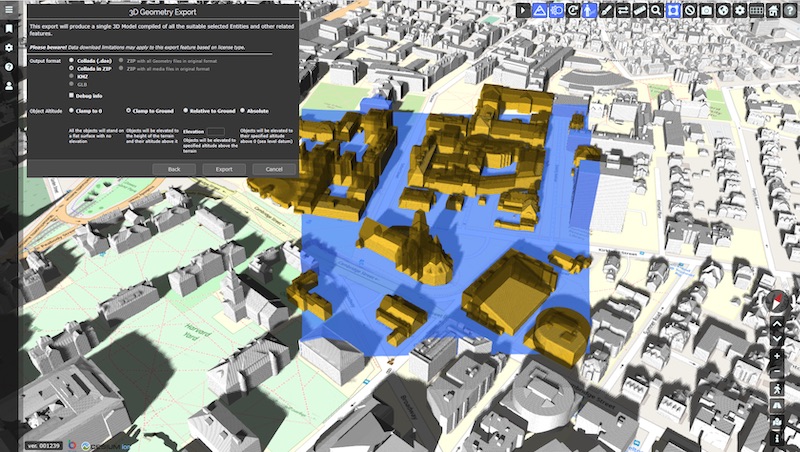
 It’s easy to find and select relevant datasets for a specific area, such as Cambridge, MA.
Downloads are available in Collada (DAE) and KML/KMZ formats, and users can upload them to their own Cesium ion accounts or visualize them in other applications such as Rhino, SketchUp, and Revit at any time. KML format will also soon become available.
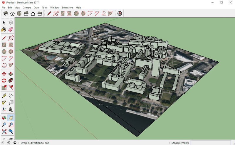
 3D geometry exported from EdgyGeo visualized in SketchUp.
With this customizable download option, subscribers can obtain the local datasets needed for specific projects, linking GIS, AEC, BIM, and construction tools in a simple data download and transfer process.
You can try the tool by contacting EdgyGeo CEO Kevin DeVito.
Author: Sarah Chow
Original link: https://cesium.com/blog/2020/03/03/edgygeo-3d-tiles-download/
Comment: Cesium ion appears to be the officially recommended data storage and management tool from Cesium. Looking at future developments, we recommend using the download tool described in this article along with Cesium ion.
Cesium Chinese Website QQ Group: 807482793
Cesium Chinese Website: http://cesiumcn.org/ | Fast Domestic Access: http://cesium.coinidea.com/